FOR IMMEDIATE RELEASE
September 20, 2018
For more information, contact us.
Earth Big Data Uses Open Satellite Data to Reveal the Extent and Impact of Hurricane Florence
Woods Hole, Mass. – Earth Big Data, LLC, has used publicly available satellite data to reveal the extent and impact of Hurricane Florence on inland and coastal communities of North and South Carolina as the eye made landfall.
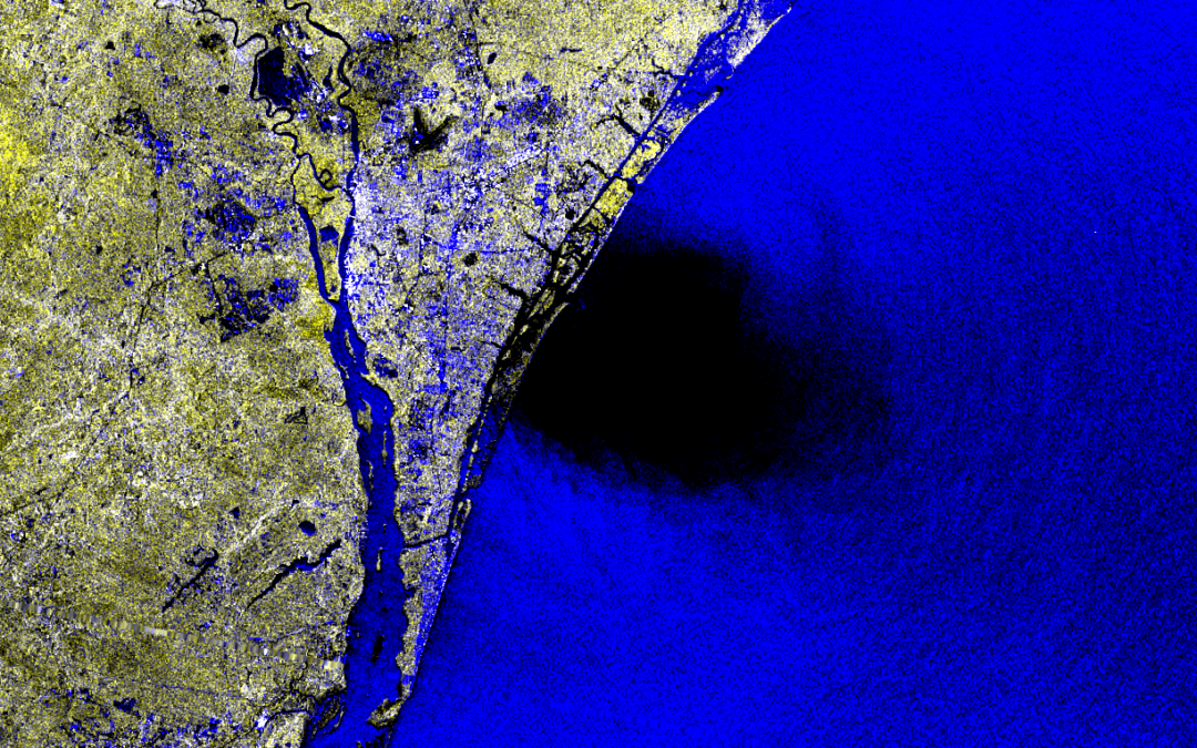
The images below show the eye and much of the storm as Florence made landfall near Wrightsville Beach, N.C., on Friday, September 14 at 7:15 a.m. The image was acquired by the European Space Agency’s Sentinel-1B Synthetic Aperture Radar satellite. The satellite’s long wavelength radar is capable of penetrating cloud cover to reveal details about the land and sea surface that are not easily seen on such broad spatial scales during life-threatening events like large storms.
The image covers a region roughly 160 by 410 miles. It is a false-color composite that combines data from the radar’s two measurement modes that detect polarities of energy returning from microwave pulses emitted by the satellite.
The eye of the hurricane is clearly visible as a black, roughly circular feature just touching the coastline. The blue color over water shows the active hurricane extent where ocean conditions are rough and enhance the radar signal. The blue areas over water indicate regions of high wave activity that enhance the radar return to the satellite.
The bright yellow colors over land, particularly north of the eye, indicate increased moisture on the ground from heavy rainfall. The edge of the inundated region is about 120 to 130 miles from the center of eye.
“Images like these demonstrate the power of big geospatial datasets in helping emergency managers deal with massive events like Florence,” said Josef Kellndorfer, President and Senior Scientist of Earth Big Data. “Unless they are able to see the full extent of a storm or a wildfire, they can’t fully address its potential impact on society and the environment.”
Data were acquired from the NASA Alaska Satellite Facility and processed by Earth Big Data LLC with cloud computing technology using special algorithms to manage and process large amounts of data.
Earth Big Data LLC is based in Woods Hole, Massachusetts, and specializes in geospatial big data mining and remote sensing data analysis using modern cloud computing. For additional information, please contact us.
###
Image 1: 160 by 410 mile false-color satellite image showing the extent of rain-moistened land and wave-roughened sea surface surrounding the eye of Hurricane Florence as it made landfall on September 14, 2018.
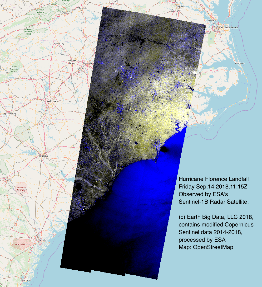
Image 2: Close-up view of the eye of Hurricane Florence surrounded by regions of high wave activity and heavy standing water on land as the storm made landfall near Wrightsville Beach, N.C.